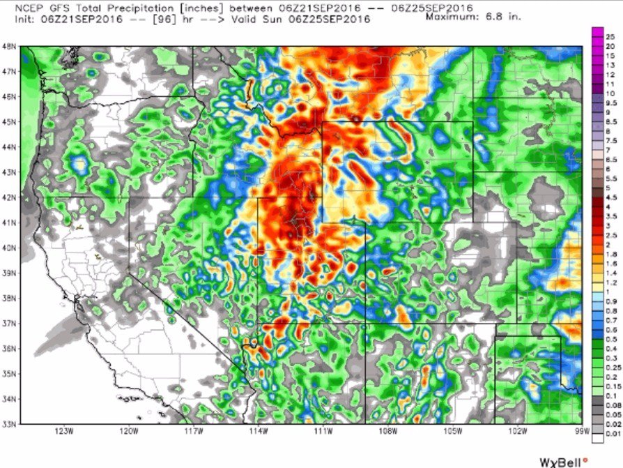
Yes, you read that correctly. The 2016/2017 winter in Utah may be coming earlier than expected and in a BIG way. The Wasatch Snow Forecast released the following statement regarding this weekend's forecast of 6-12 inches of snow.
"Obviously, the limiting factor for snowfall accumulations is the fact that the first 36 hours or so of this storm will be rain for virtually all elevations. Once the snow does arrive though, it should start piling up for the high elevations. If this were mid-winter and it were all snow, we’d be talking about the potential for FEET of snow. But, as it is, I’d say we are more likely to be in the 6-12″ range above 8,000 feet. I do think the highest elevations could easily top a foot. Between 6k-8k feet, anywhere from a dusting to 6 inches is possible.

It’s a tough storm to forecast because it’s complex and is very dependent on when and how much snow levels fall. Personally, I’m hoping it’s a bit of a dud. This amount of moisture and snowfall would likely put a premature end to high elevation mountain biking. I’m not ready to give that up just yet. However, can’t deny that it will be nice to see a blanket of deep white on the mountains this weekend!"

NOAA forecast for the central Wasatch at 10,000 feet
While this is certainly exciting news for all us skiers who want to get some early turns in before the lifts start spinning, one Facebook commenter brought up this point: "Not good if it really is going to snow that much then sit and rot till Mid-November. That is going to make for some really dangerous avalanche conditions if that just sits there and becomes faceted for a month and a half. I hope we have a warming trend to melt this thing off? What is the long range showing you WSF?"
IF it does end up snowing the expected 6-12 inches in the higher elevations, who plans on getting a few late September pow turns in?


Comments